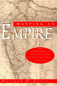
Mapping an Empire: The Geographical Construction of British India, 1765-1843
Matthew H. Edney
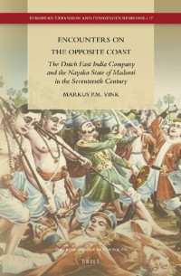
The reshaping of cartographic technologies in Europe into their modern form, including the adoption of the technique of triangulation (known at the time as "trigonometrical survey") at the beginning of the nineteenth century, played a key role in the use of the GTS as an instrument of British cartographic control over India. In analyzing this reconfiguration, Edney undertakes the first detailed, critical analysis of the foundations of modern cartography.
年:
1997
出版商:
University of Chicago Press
語言:
english
頁數:
458
ISBN 10:
0226184889
ISBN 13:
9780226184883
文件:
PDF, 53.69 MB
IPFS:
,
english, 1997
 Amazon
  Barnes & Noble
  Bookshop.org
  轉換文件
轉換文件 更多的搜索結果
 其他特權
其他特權 


最常見的術語
相關書單